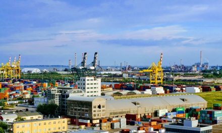

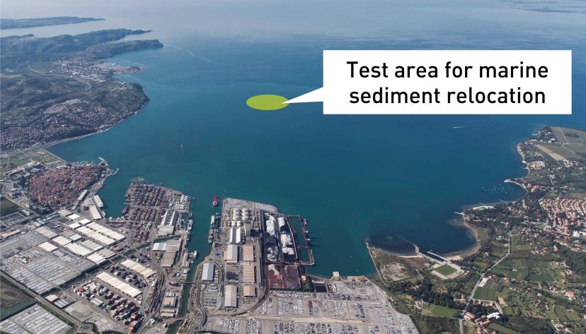
KOPER – The Port of Koper will be able to dispose of the sludge derived from dredging by pouring it directly into the sea. The technical details are yet to be determined, while the regulatory reference is the Maritime Space Plan, adopted after a 2014 EU directive.
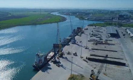
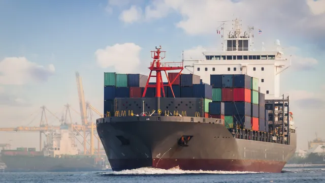
Seabed dredging at the Port of Koper
Seabed dredging is a process in which marine sediments (mud) are removed from the seabed and deposited in a specific location (“cassette”). There, the mud slowly dries, which usually takes several years. The area is then consolidated with hard material and finally asphalted or transformed into storage areas. Practically the entire port area was built in this way, except for the last two extensions of Pier I, which were built on piles. The disposal of dredged mud itself is not problematic. The problem arises due to the lack of suitable disposal areas. The legislation does not allow the mud to be dumped outside the harbour which is therefore slowly running out of space. The only land area available for dredged mud disposal is the so-called Ankaranska bonifika, a place on the right side of the Železniška cesta (road) towards Ankaran, which is also earmarked for port expansion under the National Spatial Plan. Therefore, the possibility to move the dredged mud to the seabed is of paramount importance for the further development and growth of the port.
Maritime Space Plan
Slovenia is the first EU Member State in the Eastern Mediterranean that elaborated and adopted a Maritime Spatial Plan (MSP). It entered into force on 17 July 2021 and was presented to the public by the Ministry of the Environment at the end of September. It is considered a strategic document. Namely, it is the first time since its independence that Slovenia has adopted a plan to harmonise all 12 existing activities in the Slovenian sea, such as tourism and recreational water activities, fisheries, mariculture, salt pans, underwater archaeological heritage and others. In 2014, the European Parliament adopted the Directive establishing a framework for maritime spatial planning (2014/89/EU) which encourages the Member States to promote the sustainable growth of maritime economies, the sustainable development of marine areas and the sustainable use of marine resources. As a Member State with the sea, Slovenia has embarked on preparing its first Marine Spatial Plan, which is an integrated approach to marine planning and management.
MSP’s impact on the Port of Koper
One of the MSP sections deals with the marine sector and maritime transport. The most important novelty for the Port of Koper is that it will move the material derived from the dredging of the seabed back into the sea. This sustainable approach, which is also used by other ports worldwide, will allow Luka Koper to further develop the port in line with global logistics trends, particularly the arrival of increasingly larger ships with greater draught. This was most recently done in 2014 when Luka Koper dredged the seabed at the Container Terminal to -15 metres, which allowed them to welcome larger container ships and strengthen their position in the northern Adriatic. Dredging is also essential to maintain navigation safety. In the port of Koper, they need to maintain a certain depth in the basin at all times to ensure the smooth passage of ships. Dredging or cleaning of the seabed is carried out on an as-needed basis. Dredged material has so far been disposed of in designated locations known as “cassettes” within the port area.
Selection of dredging technique
When approaching seabed dredging, the choice of the right dredger is most important. Dredgers are divided by size, dredging technology and intended use. For the 2014 dredging, the contractor of the Port of Koper, the Dutch company Van Oord, used a suction dredger. It first suctioned the mud with a suction pump, stored it in the hull, then connected to a hose in Basin III and pumped the contents of the dredged mud into the “cassette”.
To transfer the dredged material back to the seabed, a different technique will have to be used. The decision concerning the most suitable method will be adopted during the planning phase. Before that, however, the required analyses and surveys will have to be carried out, including also archaeological surveys of the seabed at the planned locations.